Byway Attractions
Shelf Road - 01
Shelf Road
38.614739, -105.224925
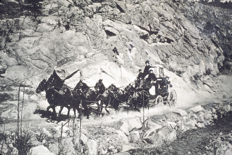
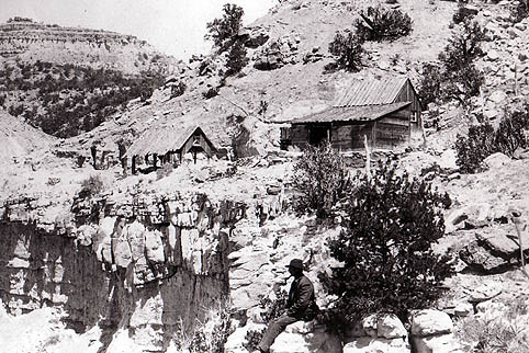
Shelf Road transformed an untraveled wilderness into a major route for the stagecoaches and freight wagons traveling between the Arkansas Valley and the Cripple Creek Gold Mining District. The rugged route’s name is ‘THE SHELF’, a five-mile stretch of road that hugs the sheer rock walls of above Fourmile Creek.
Originally called the Cañon City and Cripple Creek Toll Road, Cañon City’s business leaders financed the road. The toll collectors lived in small cabins nestled at either end of the Shelf and collected tolls every time a horse, wagon or stagecoach passed.
The toll varied from 30 cents to $1.75 for single riders, wagons, and stagecoaches. Ranchers driving cattle along the road paid for each head. Eventually, competition from railroads put the toll road out of business. Fremont County purchased the road and opened it as a free road. This road has made for a memorable trip since its construction in 1892 so be prepared for a driving adventure.
A Look at Shelf Road
Shelf Road - 02
Oil Well Marker
38.513253, -105.208504
In 1880, a grain miller named Gabriel Bowen filed a claim to an oil spring on the east bank of Four Mile Creek. Within two years, A.M. Cassidy and his partners had acquired the oil spring and drilled a well- the first oil well in Colorado. Wagons hauled the oil to Denver, Pueblo and Santa Fe to be used as lamp oil and machine lubricant. Eventually, this small oil well led to the discovery of the Florence Oil Field in 1881.
Shelf Road - 03
Garden Park
38.573333, -105.225278
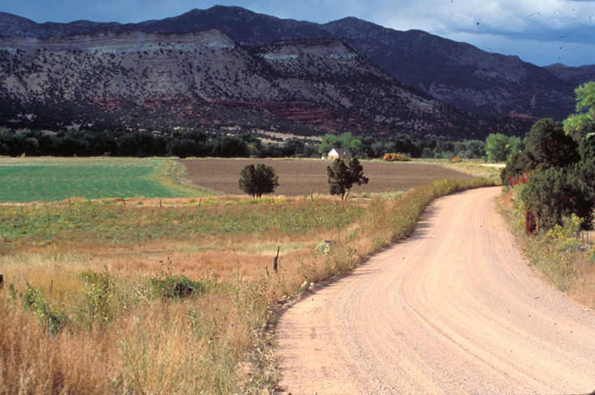
Garden Park, a classic example of a fertile down-thrown valley, lies at the base of, and is surrounded by, uplifed rocks of the Rocky Mountain Front Range. Four Mile Creek runs through Garden Park and provides a water source for irrigated agriculture. Irrigation capability made Garden Park and attractive location for settlers who took advantage of free land offered by the Homestead Act of the post-Civil War period.
By 1900, over 60 families made a living in agriculture by providing produce for export to the mines in Cripple Creek and Victor. Investors from Canon City built a toll road that today is part of the Gold Belt Tour and is known as the Shelf Road. The Shelf Road, along with the Florence and Cripple Creek Railway (now the Phantom Canyon Road), were two of the three major supply routes to the mining district.
For a period of 25 to 30 years following the discovery of gold in Cripple Creek, Garden Park operated as a prosperous agricultural community, but the downturn of the fines following WWI and the end of the Gold Standard resulted in a major loss of market for Garden Park produce. As a result, homesteaders sold off land and water rights and left the valley.
A few individuals consolidated the 60+ homesteads into a handful of moderate to large ranches that persisted until recently. However, starting in the late 1990s and early 2000s, these ranches, in turn, began to be sold off and broken up in the form of subdivisions with home sites of approximately 35 acres. Once again, Garden Park has approximately 60 families, but most of them are not practicing agriculturalists. Many are retirees, and with 35 acre homes sites, the potential population density is 4 to 8 times what it was in 1890, when homesteads were 160 to 320 acres.
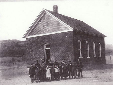
While visiting Garden Park, be sure to stop at the historic Garden Park School (1895), constructed of adobe bricks made from local soil. You may also wish to take a short walk to one of several famous sites where dinosaur fossils have been discovered or scale the cliffs of The Bank climbing area.
A Look at Garden Park
Shelf Road - 03A
Garden Park School
38.565181, -105.230047
The school structure that still stands today was originally completed in 1895 as the 2nd Garden Park School. The first having been lost to a fire in 1891 as it was constructed of wood in the late 1870s. The last classes were taught here in 1963. With only 6 students that last year the school was no longer needed and closed it’s doors after consuladation with Canon City School District. During its time the school housed many public and religious events as a local community center.
Restoration work began on the building in 2010, the west wall you see today, was nearly to collapse, but with the help of Colorado State Historical Funds the wall was disassembled, new foundation installed and then the wall was rebuilt using many of the old bricks. Work planned for 2014 includes new roof and stucco on the exterior walls.
A Look at Garden Park School
Shelf Road - 04
Cleveland Quarry
38.532614, -105.218975
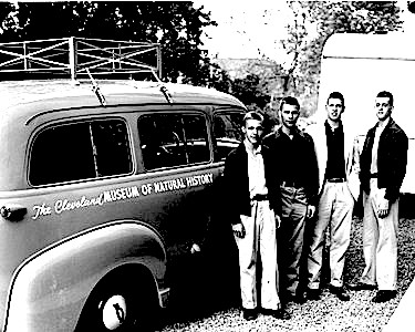
The discovery of the dinosaur site known as the Cleveland-Delfs quarry was made in the summer of 1954, on a field expedition by the Cleveland Museum of Natural History. The rare dinosaur, HAPLOCANTHOSAURUS (simple spined lizard), was found along an eroding bend of Four Mile Creek in a layer of mudstone.
Now in the Cleveland Museum, “Happy” is a giant plant-eating sauropod of the late Jurassic period, 155 to 152 million years ago and represents a new species called HAPLOCANTHOSAURUS delfsi, named after Dr. Edwin Delfs, M.D., leader of the original crew who located this rare dinosaur in Garden Park. (See photo.)
Dr. Delfs returned to Garden Park in 1991 for the dedication of a plaque in recognition of his discovery. (See photo.) This is the largest known and only HAPLOCANTHOSAURUS to be mounted and on permanent display in the United States.
A Look at Cleveland Quarry
Shelf Road - 05
March Quarry Trailhead
38.535033, -105.221747
Marsh-Felch Quarry 1977. Started when O.C. Marsh sent employee Benjamin Franklin Mudge out to Canon City to investigate the claims of such large fossils being discovered and shipped back to Cope by Lucas for further research. Mudge attempted to persuade Lucas to send any specimens back to his boss O.C. March. But after little success Mudge began working with a local farmer named Marshal P. Felch who had also started his own quarry in 1877 only about a mile from the Cope Quarry. Those excavated dinosaur bones were sent back to O.C. Marsh.
A Look at March Quarry Trailhead
Shelf Road - 06
Canterbury Homestead and Toll Gate
38.623406, -105.219600
The Shelf Road was made as a means of travel between Canon City and Cripple Creek. After the discovery of gold to the north, business men from Canon City saw the road as an investment opportunity and began to charge a toll for its use. A stage line was established around 1894 along the road by Charlie Canterbury Sr. and E.C. Higgins.
Canterbury operated the lower toll gates and Higgins drove the stage. The stage line only lasted a few years until the railroad routes were established. But Canterbury decided to homestead there in a canyon near his toll gate.
Shelf Road - 07
Marigold Town Site
38.663178, -105.225125
Marigold was a stage stop between Victor and Cripple creek and was a construction camp for the Carlton Tunnel between 1930 and 1941. It had a post office between 1895 and 1902 and is seasonally occupied with several era structures.
Shelf Road - 19
Carlton Tunnel
38.665154, -105.226300
Completed in 1942 as a drainage tunnel from Vindicator to Marigold. This tunnel further increased the drainage abilities of the deeper mines around Victor. The tunnel was dug so straight it was possible to see the tiny pinpoint of light opening a little over 6 miles away. It allowed mines like the Ajax, Portland 2 and Cresson to reach depths between 2,300 and 3,000 below the surface without flooding. Water from the Carlton Tunnel still flows adjacent to Fourmile Creek.
Shelf Road - 20
Cañon City
38.446800, -105.228305
Settled by the Anson Rudd family in 1860, Cañon City quickly became a regional center for commerce. The Arkansas River and its numerous tributaries provided ample water for agricultural, residential and industrial uses. Farms, ranches and orchards flourished in the fertile soils along the river. Silver and gold discoveries in the surrounding mountains provided a ready market for Cañon City farmers and merchants.
Wagon roads and railroads proved critical to Cañon City’s success. Wagon and stagecoach roads stretched south to the silver mines near Westcliffe and Silvercliffe and northwest to the silver and gold mines of Alma, Fairplay and Leadville. In the late 1870s, the Atchison, Topeka and Santa Fe Railroad (AT&SF) and the Denver and Rio Grande Railroad (D&RG) arrived in town.
With the gold discoveries in Cripple Creek, a group of Cañon City businessmen quickly financed and built the Toll Road (Shelf Road) in 1892. When the Railroad was built up Phantom Canyon in 1894, which proved more efficient connection than the wagon road. Cañon City still managed to get a piece of the action by convincing the Railroad to build a branch line inot Canon City and share facilities with D&RG in 1899.
Today, Cañon City’s downtown historic district contains eighty-one buildings that reflect the town’s prosperity between 1870 and 1930. Downtown offers a variety of shops, restaurants and galleries.
Shelf Road - 21
Museum of Colorado Prisons
38.439430, -105.247290
Located on the western end of Canon City this unique museum welcomes visitors to explore the history of Colorado Corrections. Individual MP3 audio tours guide visitors through 32 cells filled with exciting exhibits and life sized models that link the past to the present in dramatic presentation.
Other artifacts and exhibits include: The hangman's noose used for the last execution by hanging in Colorado. Confiscated inmate weapons and contraband. The last gas chamber. Rare, historic photographs depicting life in prison facilities. Displays of disciplinary paraphernalia used from 1871 to the present. Inmate Arts and Crafts. Gift Shop and much
Shelf Road - 22
Territorial Prison
38.436609, -105.248854
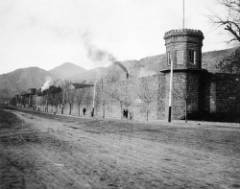
Originally built in 1871, 5 years before Colorado reached official statehood, the prison became the first in the territory. After reaching statehood, Territorial Prison became the first official state prison and housed Colorado death row inmates for a long time.
A Look at Territorial Prison
Shelf Road - 23
Peabody Mansion
38.438716, -105.244627
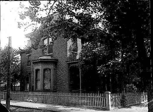
Built in the 1880s for James Clelland a local business man heavily involved in real estate, merchandising and grocery. The Peabody Mansion was used as a focal point of meetings with governors, financial managers, politicians and business leaders. It was named after future Colorado Governor James H. Peabody who originally worked for Clelland as a bookkeeper.
A Look at Peabody Mansion

